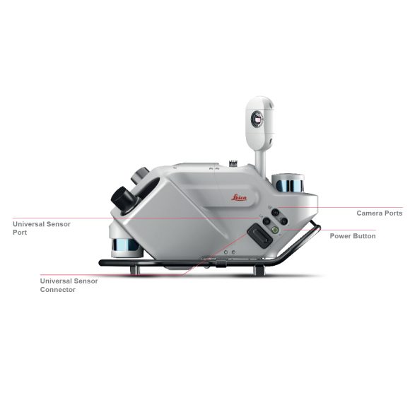
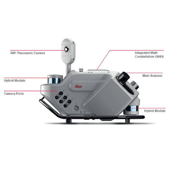
Description
This is the Future of Mobile Mapping
Autonomous. Intelligent. Simplified.
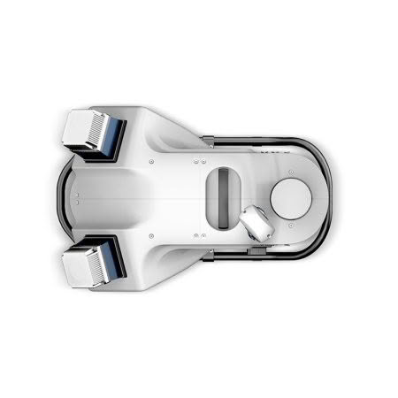
The Leica Pegasus TRK500/700 Evo is robust and reliable so you can map even the most demanding environments, delivering unchallenged performance for real-time results. The Pegasus TRK delivers greater levels of precision for critical transportation infrastructure maintenance in more clarity, faster than ever, to unlock new business opportunities.
The Future is Autonomous – Transforming mobile mapping with autonomous data collection for project completeness.
The Future is Intelligent – Delivering intelligence with advanced positioning, data-efficient sensors and adaptive imagery systems for rich, immersive detail to expand use cases.
The Future is Simplified – Simplifying set-up, operation and application to expand opportunities while reducing personnel resource requirements.
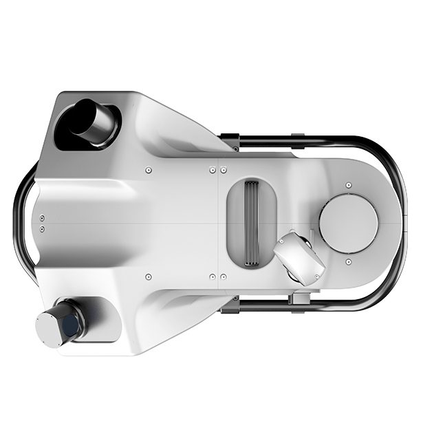
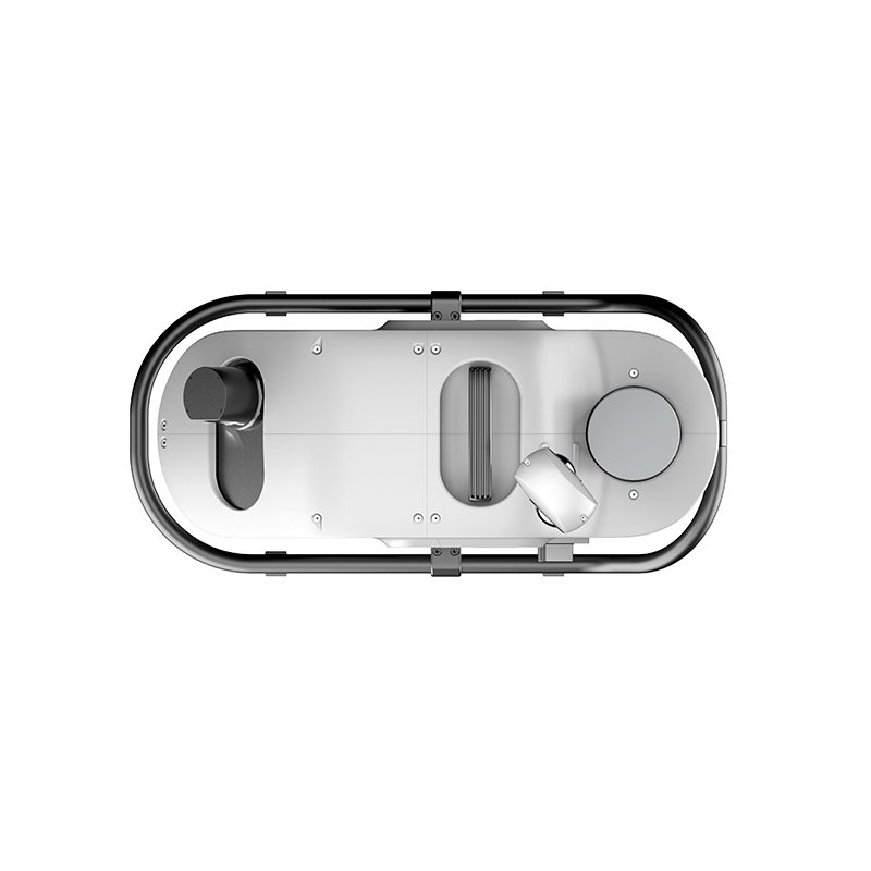
Pegasus TRK500 Evo – The data Efficient single scanner option, capturing 1,000,000 points per second.
Pegasus TRK700 Evo – With dual scanners for when greater point cloud density is required, capturing 2 million points per second.
Expand for more possibilities
Pegasus TRK puts mobile mapping in the hands of more people than ever before. Simple to operate, the Pegasus TRK requires less training so you can cut costs but not performance. Weighing in at just 17kg with a unique rotating-tilting mounting platform and ergonomic design, Pegasus TRK can safely be set up and operated by just one person. Intuitive software guides you from project planning to project delivery.
Your world in millimeters
Measure roads and railways with surgical precision at the speed of traffic. Critical infrastructure was never easier to maintain. Proven accuracy meets next level precision with the Leica Pegasus TRK Evo. Structural imperfections become evident in dense and crisp point clouds. High-definition scanning and dedicated high-resolution pavement cameras take road inspection to the next level.
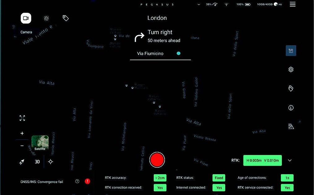
The mastermind behind it all
Plan and execute projects with confidence. Spontaneous visual and audio feedback along the route makes data collection failure a thing of the past. Pegasus FIELD predicts the time required for planned missions and storage and battery capacity needed to perform the job. Throughout the journey, image previews, accuracy estimations, and live system feedback instill absolute confidence in the data acquisition process.