
Time is not always a friend to our treasured and historic structures. Whilst these structures present architectural challenges as they age, the need to preserve and evolve each one carefully and thoughtfully is necessary for their long-term survival. Around the world, architecture, engineering and construction (AEC) professionals work to implement new technology in renovation and… Continue reading The Vital Role of Laser Scanning in Heritage Conservation
Global Survey News
How is the New Leica Nova MS60 MultiStation Different?
In simple terms, the new Leica Nova MS60 MultiStation is a new class of instrument, based on a Total Station but with the power to “do it all”. When Leica Geosystems introduced the world’s first MultiStation in 2013, the MS50, they introduced the term “mergeTEC” to represent the merging of technologies. This term still fits… Continue reading How is the New Leica Nova MS60 MultiStation Different?
Accelerating Construction Layout with Digital Construction Tools [Webinar]
An Introduction to the Leica iCON Construction Range The construction industry is on the verge of adopting a range of new technologies. With increasingly complex job sites, what is the best way for construction firms to thrive? Two words: Going digital. Many progressive organisations and contractors have already eliminated rework and streamlined workflows through digital… Continue reading Accelerating Construction Layout with Digital Construction Tools [Webinar]
Leica Robotic Total Stations Comparison Chart
Keen to know where the new model Leica Nova MS60 Multistation fits into the Leica Geosystems line up of Robotic Total Stations? See all the most important specifications at a glance in this handy comparison chart. Leica Robotic Total Stations: Specifications Leica TS13 Leica Viva TS16 Leica Nova TS60 Leica Nova MS60 Angular Accuracy 1″,… Continue reading Leica Robotic Total Stations Comparison Chart
Upgrade Options For Leica Rugby Upgradable Lasers
The world’s first upgradable lasers are revolutionising the industry by offering unprecedented flexibility and the ability to adjust to your project’s needs. Choose between 2 base models with multiple upgrade options. Upgrade now or at any time in the future. With the Leica Rugby Lasers you only pay for the functionality you need to do your… Continue reading Upgrade Options For Leica Rugby Upgradable Lasers
Leica ULTRA | The Ultimate Utility Tracing System
The Leica ULTRA Utility Tracing System delivers accurate and reliable information to protect buried assets and accurately map their location in order to plan for excavation activity. As development of infrastructure in New Zealand has progressed, our network of underground pipes and cables has also expanded and become more complicated. Effective detection and mapping of… Continue reading Leica ULTRA | The Ultimate Utility Tracing System
Leica BLK3D: Ultimate Onsite Documentation & Collaboration [Webinar]
The Leica BLK3D captures images and 3D measurements from 2D photographs using stereo photogrammetry and edge computing, which can then be shared in multiple formats. This webinar will show you how to use the BLK3D for ultimate onsite documentation and collaboration in conjunction with the Leica RTC360 and Leica BLK360. Onsite documentation can be enhanced… Continue reading Leica BLK3D: Ultimate Onsite Documentation & Collaboration [Webinar]
Say Hello to engcon Tiltrotators!
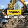
We’re excited to announce that Global Survey have become an engcon dealer offering a full range of tiltrotators, buckets and attachments to Civil Contractors across the country. “We believe engcon tiltrotators deliver incredible versatility, productivity and cost savings for Contractors, enabling some tasks to be completed up to 50% quicker. Engcon’s innovation and advanced technology… Continue reading Say Hello to engcon Tiltrotators!
Ground Penetrating Radar Made Easy | Leica DSX Utility Detection System
Introducing the Leica DSX – an all in one utility detection system designed for non-experienced and first time ground penetrating radar [GPR] users. It is a highly advanced yet easy-to-use solution for locating and mapping buried utilities in a safe, fast and reliable way, without the costs of hiring a specialist. Investing in the Leica… Continue reading Ground Penetrating Radar Made Easy | Leica DSX Utility Detection System
Context Architects Secure First Leica BLK2GO in NZ!

Congratulations to Context Architects on securing the first Leica BLK2GO hand-held mobile laser scanner in New Zealand. Context Architects are not your ordinary architecture firm, their 70-strong team of architects, urban, interiors/retail designers and remediation specialists are passionate about the power of good design to lift people’s lives. The Leica BLK2GO fits perfectly into their… Continue reading Context Architects Secure First Leica BLK2GO in NZ!