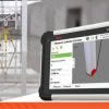
Leica Captivate survey field software remains at the forefront of Leica’s ongoing development efforts. As technology and industry demands evolve, Leica’s R&D team remains determined in their efforts of ensuring that the Captivate software not only aligns with but surpasses the requirements and expectations of surveying professionals worldwide. The new Leica Captivate v8.0 was released… Continue reading Leica Captivate v8.0 – Overview of new features
Global Survey News
University of Canterbury: Embracing technology for the next generation of Engineers
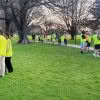
The University of Canterbury Department of Civil and Natural Resources Engineering is known internationally for its successful engineering programmes. In close consultation with industry, the survey teaching module has been redeveloped in 2023 to prepare the new generation of engineering graduates to suit the needs of the modern profession and clients. Delivered within the second… Continue reading University of Canterbury: Embracing technology for the next generation of Engineers
Babbage: Leica RTC360 delivering maximum scanning efficiency on the O Mahurangi – Penlink project

We join the Babbage survey team onsite to discover how they’re using Leica laser scanning technology to complete over 200 condition surveys of buildings located alongside the new O Mahurangi – Penlink transport link in Auckland. On this project, it was important for the Babbage team to ensure that they met the wider goals… Continue reading Babbage: Leica RTC360 delivering maximum scanning efficiency on the O Mahurangi – Penlink project
Mexted Sports Turf: Resurfacing Eden Park with the Leica iCON 3D Grading System
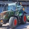
We’re onsite with the team from Mexted Sports Turf at Eden Park in Auckland. After three years, they’ve returned to again complete a resurfacing project at New Zealand’s National Stadium. With short time frames and an entire stadium ground to resurface, the pressure was on to get it right first time. This project involved taking… Continue reading Mexted Sports Turf: Resurfacing Eden Park with the Leica iCON 3D Grading System
Harrison Grierson: Bringing projects to life with the Leica BLK2GO

On a crisp Wellington morning, we joined the Harrison Grierson survey team onsite at the Bowen Campus buildings adjacent to Parliament Grounds in Wellington. This large construction project spans a 1 hectare site comprising of four commercial office towers that will house approximately three and a half thousand workers when complete. The site includes a… Continue reading Harrison Grierson: Bringing projects to life with the Leica BLK2GO
Everything you need to know about Unmanned Surface Vessels from Seafloor Systems
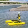
Seafloor Systems are continuing to develop and improve their hydrographic surveying solutions, including the popular EchoBoat and HydroCat systems. As an affordable and effective surveying platform, these systems are highly versatile and can be customised to suit individual, environmental and project requirements. Unmanned Surface Vessels (USVs) are commonly used by Surveyors to overcome access challenges,… Continue reading Everything you need to know about Unmanned Surface Vessels from Seafloor Systems
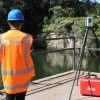
Harnessing the Power of GNSS for Monitoring Hydro Energy Infrastructure
Hydro energy infrastructure plays a crucial role in the sustainable development of renewable energy sources. The structures that support Hydro Energy are subject to continuous environmental forces, especially in the New Zealand tectonic environment , that can cause deformation, displacement, and even failure. To ensure the long-term integrity and reliability of these assets, it is… Continue reading Harnessing the Power of GNSS for Monitoring Hydro Energy Infrastructure
Introducing the CHC AlphaAir 450 LiDAR: Smaller, lighter sensor for Drone Surveying
3D terrain mapping with drones has become common practice over the last decade. Relatively low-cost drones combined with autonomous mission planning apps and user-friendly photogrammetry software (such as ContextCapture and Leica Infinity amongst others) have provided highly efficient workflows for building accurate and complete 3D models of terrain more quickly and safely than traditional ‘boots… Continue reading Introducing the CHC AlphaAir 450 LiDAR: Smaller, lighter sensor for Drone Surveying
Abley: Optimising augmented reality in construction with vGIS
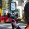
The recent industry survey by Deloitte for Autodesk “The state of digital adoption in construction report 2023” showed that businesses using digital technologies are more likely to be successful across a number of measures including revenue growth and optimism about the future. The adoption of digital technologies under an organisation-wide strategy that includes training and… Continue reading Abley: Optimising augmented reality in construction with vGIS
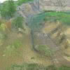
McLeod Cranes: Cleaning up the Waikato Te Awa river with the Leica RTC360
Did you know there are approximately 200 cars on the bottom of the Waikato Te Awa River? The Leica RTC360, a 230 tonne crane and bathymetric sonar have all been key elements in the cleanup efforts of this debris. It’s a picture perfect autumn day in the Waikato as we join the McLeod Cranes team… Continue reading McLeod Cranes: Cleaning up the Waikato Te Awa river with the Leica RTC360