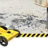
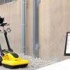
The market for utility locating equipment and ground penetrating radar is evolving. The process of underground utility location, identification and labeling is necessary to increase safety and reduce the risk of accidently damaging buried assets. The traditional way to locate a buried utility is with an electro-magnetic locator but the difficulty with this technology is that… Continue reading Meet the Leica DS2000 Ground Penetrating Radar
Global Survey News
Leica Partners With Geolantis Utility Mapping Software
Leica Geosystems have partnered with Geolantis utility mapping software to provide an enterprise-grade solution for Leica detection products. Michael Pegam, CEO of Geolantis says “The combination of Leica Geosystems premium solutions and our cloud based platform is a unique offering. Users around the world benefit from this combination of leading technology, streamlining operations and saving valuable time.… Continue reading Leica Partners With Geolantis Utility Mapping Software
Dealing With The Leap Second Switch

What Is A Leap Second? We all know that a Leap Day synchronises our current calendar year with the solar year; the length of time it takes the Earth to orbit around the sun. But what is a Leap Second and why is it important to Surveyors? It’s exactly the same concept with a Leap… Continue reading Dealing With The Leap Second Switch