After an incredible launch event last year the New Zealand BIM Conference 2018 is set to be bigger and better in 2018. The BIM Conference is an opportunity for construction sector professionals to engage and collaborate on the uptake of BIM across New Zealand. This year, our BIM specialist Tim Jervis will be speaking on “The Evolution of Reality… Continue reading New Zealand BIM Conference 2018
Global Survey News
Leica GS18 T | Your Questions Answered
Since its launch, the revolutionary new Leica GS18 T has been making headlines around the world as the greatest innovation for surveyors for years. Here in New Zealand, the geomatics team at Global Survey have been busy with demand for demos from new and existing customers. The new self-calibrating Leica GS18 T with full tilt… Continue reading Leica GS18 T | Your Questions Answered
Bentley Reality Modelling Workshop

Global Survey and Bentley Systems would like to invite you to a FREE Reality Modelling Workshop. Reality Modelling is a major component of engineering, being used in construction, design, monitoring changes, asset condition inspection – the possibilities are endless! Are you looking to create high quality deliverables with images captured from your UAV? With ContextCapture, you… Continue reading Bentley Reality Modelling Workshop
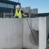
Locate Underground Objects | Leica GPR
The Leica GPR solution provides roading, earthworks, concrete contractors and council developers/asset managers the ability to quickly analyse underground objects across large areas. Risks can then be identified and minimised before earthworks begin, greatly improving safety onsite. The advantage of using Leica GPR is the ability to quickly see a full picture of what’s going… Continue reading Locate Underground Objects | Leica GPR
Beyond The Electronic Bubble | The Leica GS18T Story

The GNSS Evolution This is the story of a decade-long quest for sensor integration, the results of which provide a glimpse into the future of not only GNSS rovers, but also perhaps other surveying and mapping instruments to come. The key differences between Leica Geosystems’ GS18 T tilt compensation and that of many other systems… Continue reading Beyond The Electronic Bubble | The Leica GS18T Story
The Power of Scanning – Leica HDS Webinar

** This webinar has already happened but the recording is now available. ** Webinar Recording Available Here ‘The Power of Scanning’ webinar will discuss and introduce the new Leica RTC360 3D Reality Capture solution from data capture to in-field verification and preregistration. The new Leica RTC360 is a new ultra-fast medium-sized 3D laser scanner designed… Continue reading The Power of Scanning – Leica HDS Webinar
ScanStation Comparison Chart – BLK360/RTC360/P-Series
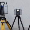
With Leica’s ever-increasing portfolio of scanning solutions, it’s hard not to be excited by the evolution of this industry. Our latest release, the RTC360, offers lightning fast pointcloud and HDR image capture with cutting edge in-field smart registration. When combined with the speed, scale and simplicity of Cyclone Register360, you’ll find that delivering precise data… Continue reading ScanStation Comparison Chart – BLK360/RTC360/P-Series
Welcome back to Global Survey Richard Harrison!

We’re pleased to welcome Richard Harrison back to the Global Survey team as South Island Geomatics Specialist. After 4 years working in a professional services consultancy Richard is back, bringing with him an even richer background, now including international survey experience, product training, service, technical support and management. Richard’s most recent experience was focused on the… Continue reading Welcome back to Global Survey Richard Harrison!
Leica HDS User Conference
Join the Global Survey team at the upcoming Leica HDS User Conference to discover the latest technologies destined to shape our industry. HDS User Conference – Melbourne, 14-15 August 2018 Join like-minded professionals in Melbourne to learn, network and discover what’s new and what’s next in HDS technology. You’ll see the latest HDS solutions on display, including… Continue reading Leica HDS User Conference
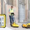
Leica iCON GPS 70 T – Increased productivity, speed and accuracy
Operate faster, smarter and easier with the new Leica iCON GPS 70 T. Fully calibration-free, the Leica iCON GPS 70 T enables you to operate at maximum efficiency with the latest technology. The ultimate GNSS rover is a fully tilt compensated solution delivering increased productivity onsite. Now you can collect topographic and as-built field data,… Continue reading Leica iCON GPS 70 T – Increased productivity, speed and accuracy