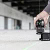
Hiring construction and survey equipment can be the perfect solution if you need a specific instrument short-term or if you want to try the latest technology in the field for an extended period of time. Leica equipment hire is a good option if the job is starting soon and you need the equipment calibrated and… Continue reading Increase your efficiency with Leica equipment hire
Global Survey News
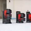
Introducing New Leica DD Cable Locators
The new range of DD cable locators from Leica Geosystems delivers a complete solution for utility detection professionals or anyone who needs to know where utilities are located. Choose between the high-tech DD SMART locators with advanced features and superior connectivity and the entry level DD100 series designed to get the job done quickly and… Continue reading Introducing New Leica DD Cable Locators
Halving Field Time With Multi-Constellation GNSS [by Bruce Robinson]
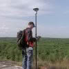
Improving Field Efficiency of Cadastral Surveyors My premise is that greater satellite numbers can dramatically improve field efficiency. Cadastral surveyors typically have a common procedure for minimising the chances of bad GNSS fixes by measuring a survey mark twice. The 2 fixes are typically separated by at least 1 hour to ensure that the GNSS geometry… Continue reading Halving Field Time With Multi-Constellation GNSS [by Bruce Robinson]
Leica Lino Comparison Chart
The new range of Leica Lino cross and point line lasers have arrived! Use our handy comparison chart below to compare models and chose the right Lino to suit your needs. Leica Lino Comparison Chart: L2P5G L2G L2P5 L2 P5 Lase Color Green Green Red Red Red Range up to 35 m up to 35… Continue reading Leica Lino Comparison Chart
Introducing New Leica Lino Lasers
Meet the new Lino cross and point line lasers from Leica Geosystems! In addition to the accuracy and precision you’d expect from a Leica Lino Laser, this new range offers two important new features: High visibility of the laser lines Ability to position the laser quickly and precisely This new range has been especially created… Continue reading Introducing New Leica Lino Lasers
New SmartFix Reference Stations in the North Island
It is exciting to be able to continue to grow the SmartFix reference station network. In the last few weeks two new stations have been made active in Kerikeri (GSKK) and Whangarei (GSWR). The GSWR has been established to help overcome some of the problems associated with the location where WHNG is located. There are… Continue reading New SmartFix Reference Stations in the North Island
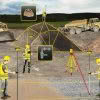
Where Art Meets Scanning | Auckland’s Underground Lava Caves [Interview]
A city located on a volcanic isthmus, Auckland is home to a large number of dormant and extinct volcanoes. Volcanic cones are quite literally everywhere shaping the landscape of this sprawling city and sitting alongside many seemingly peaceful inner city suburbs. What many of us living in Auckland may not realise is that beneath our… Continue reading Where Art Meets Scanning | Auckland’s Underground Lava Caves [Interview]
Get the most out of your Leica BLK360 [Webinar]
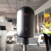
** This webinar has already happened but the recording is now available. ** Webinar Recording Available Here Get the most out of your Leica BLK360: Deliver meaningful information The BLK360 is proving to be versatile across many applications and industries. At the touch of a button, you can capture 3D point cloud data at 360,000… Continue reading Get the most out of your Leica BLK360 [Webinar]
Are You Putting Off Equipment Repairs?
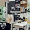
Survey and construction equipment is built rugged by design. It has to be tough to withstand the dust, water, and other rigours of use in outdoor construction environments. With that in mind, servicing equipment regularly still plays a large part in ensuring the longevity of it’s working life. To keep your equipment operating accurately and… Continue reading Are You Putting Off Equipment Repairs?
Introducing New Leica DISTO X3 and X4
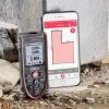
Leica Geosystems recently announced two new laser distance metres for measure up and construction, DISTO X4 and X3. The DISTO X4 is specifically designed to make high-precision outdoor measurements an easy task. The DISTO X4 is equipped with a Pointfinder camera, allowing users to easily target distant objects in bright sunlight. Even if the laser… Continue reading Introducing New Leica DISTO X3 and X4