
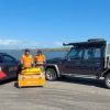
In the competitive world of earthmoving and excavation, efficiency, precision and adaptability are what sets Contractors apart and provides them with a competitive edge. For Hawke’s Bay-based contractor Can You Dig It, these aren’t just buzzwords; they are the guiding principles that have propelled them to stand out in their region. Founder Paris Richards left… Continue reading Embracing Smart Technology – Can You Dig It’s Journey
Global Survey News
Introducing the New Leica BLK360 SE Laser Scanner and PinPoint Software!

Precision, simplicity and affordability converge in Leica’s latest laser scanning release — the BLK360 SE! Designed to provide fast, accurate and highly portable scanning capabilities, the Leica BLK360 SE is designed to enhance workflows in architecture, construction, engineering and beyond. When paired with PinPoint software, users unlock a streamlined, powerful solution for data processing, visualisation,… Continue reading Introducing the New Leica BLK360 SE Laser Scanner and PinPoint Software!
Mills Albert Providing High-Tech Tenstar Simulator Training

In a modern training centre in Paraparaumu, a trainee carefully maneuvers the controls of an excavator, precisely building a stockpile of large rocks. Nearby, another trainee navigates an articulated dump truck through the same worksite, maintaining a safe working distance. While the heavy machines rumble, vibrate and sound off beneath the young trainees’ hands, these… Continue reading Mills Albert Providing High-Tech Tenstar Simulator Training
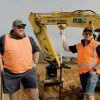
CHCNAV Apache 3 Pro: Addressing the Challenges at Whanganui Port with Hydrographic Surveying
Whanganui Port Project Overview Whanganui Port has long served as a crucial hub for both commercial and recreational maritime activities. However, recent challenges highlight the need for significant upgrades and improvements to ensure the port’s continued functionality and safety. This article outlines the challenges faced by Whanganui Port, and why a recent hydrographic survey helps… Continue reading CHCNAV Apache 3 Pro: Addressing the Challenges at Whanganui Port with Hydrographic Surveying
MS Civil: Delivering the dream result with Leica iCON technology
It’s a stunning day in the Waikato as we go onsite with the MS Civil team to discuss how their adoption of Leica iCON technology has impacted the business over the last few years. We meet at the Lockerbie Estate – sub-division in Morrinsville, where earthworks are underway for 100 lots in the current stage.… Continue reading MS Civil: Delivering the dream result with Leica iCON technology
Unlocking GNSS efficiency in challenging environments with Leica multi-frequency solutions

Selecting the right technology for a project is often dictated by accuracy requirements, with GNSS and Total Station being common choices. However, certain projects require the convenience and speed of GNSS, despite challenges like high multipath or dense overhead canopy. Traversing through thick bush with limited line of sight can be slow and budget-challenging. Leica’s… Continue reading Unlocking GNSS efficiency in challenging environments with Leica multi-frequency solutions
C&R Surveying – Efficiency gains with the Leica AP20 AutoPole
We went onsite with C&R Surveyors to see how they are utilising the Leica AP20 AutoPole on a construction project in Orewa. Jordan Zagonel, Surveyor and Gray Robinson, surveying student at Otago were tasked with surveying the site to provide stakeholders with heights, positions and details of buildings and objects. Equipped with a Leica TS16… Continue reading C&R Surveying – Efficiency gains with the Leica AP20 AutoPole
Leica Captivate surveying equipment – How to handle the 3G shutdown

In New Zealand, all the major telco providers have indicated that they will be shutting down the 3G cellular network to free up low-band spectrum to extend 5G service in rural areas. One NZ (formally Vodafone), Spark and 2 Degrees will be ending service end of 2025. This shutdown will negatively impact many technologies, including… Continue reading Leica Captivate surveying equipment – How to handle the 3G shutdown
Leica iCON Build in-field verification minimises errors and rework
Rework is a costly drain on construction projects and can be a significant problem stemming from outdated verification methods. Traditional processes often create a significant gap between identifying a potential issue and taking corrective action. Data from the job site often needs to be sent back to the office for analysis, leading to delays that… Continue reading Leica iCON Build in-field verification minimises errors and rework
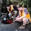
Kurloo Monitoring: Testing in New Zealand environments

The Kurloo monitoring solution for displacement and slope monitoring is a two-part system. The first part is the Kurloo device, which is mounted on the site you want to monitor. This device gathers precise data remotely using its on-board GNSS components and environmental sensors. Even small movements can be detected by the Kurloo device, making… Continue reading Kurloo Monitoring: Testing in New Zealand environments