
As part of our own internal training we decided to set our Survey Team a challenge: Measure a stockpile with the new Leica GS18I GNSS, first with the tilt pole and then with imagery using the GS18I’s innovative new Visual Positioning technology. Record the time it took to take the measurements and then analyse the… Continue reading Challenge Accepted: Testing the Leica GS18I Visual Positioning Technology
Category: Surveying & GIS News
Leica GS18 I – Imagine The Power Of Visual Positioning [Webinar]
Join us for this Leica ANZ webinar introducing the new Leica GS18 I, a versatile, survey-grade GNSS RTK rover with Visual Positioning. The new Leica GS18 I is designed for surveying professionals to measure points which previously could not be measured with a GNSS rover easily and accurately. In this webinar we introduce the Leica… Continue reading Leica GS18 I – Imagine The Power Of Visual Positioning [Webinar]
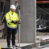
Woods Survey Team | Overcoming Construction Project Challenges
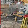
Woods have been busy flexing their construction surveying muscles on the new Quest apartments in Takapuna on Auckland’s North Shore. Bufton Construction are the main contractor tasked with building this new 5-story multi-use structure, comprised of 26 basement car parks, commercial tenancies on the ground floor, 51 hotel rooms and 6 private apartments due for… Continue reading Woods Survey Team | Overcoming Construction Project Challenges
The Vital Role of Laser Scanning in Heritage Conservation

Time is not always a friend to our treasured and historic structures. Whilst these structures present architectural challenges as they age, the need to preserve and evolve each one carefully and thoughtfully is necessary for their long-term survival. Around the world, architecture, engineering and construction (AEC) professionals work to implement new technology in renovation and… Continue reading The Vital Role of Laser Scanning in Heritage Conservation
How is the New Leica Nova MS60 MultiStation Different?

In simple terms, the new Leica Nova MS60 MultiStation is a new class of instrument, based on a Total Station but with the power to “do it all”. When Leica Geosystems introduced the world’s first MultiStation in 2013, the MS50, they introduced the term “mergeTEC” to represent the merging of technologies. This term still fits… Continue reading How is the New Leica Nova MS60 MultiStation Different?
Leica Robotic Total Stations Comparison Chart
Keen to know where the new model Leica Nova MS60 Multistation fits into the Leica Geosystems line up of Robotic Total Stations? See all the most important specifications at a glance in this handy comparison chart. Leica Robotic Total Stations: Specifications Leica TS13 Leica Viva TS16 Leica Nova TS60 Leica Nova MS60 Angular Accuracy 1″,… Continue reading Leica Robotic Total Stations Comparison Chart
Leica BLK3D: Ultimate Onsite Documentation & Collaboration [Webinar]

The Leica BLK3D captures images and 3D measurements from 2D photographs using stereo photogrammetry and edge computing, which can then be shared in multiple formats. This webinar will show you how to use the BLK3D for ultimate onsite documentation and collaboration in conjunction with the Leica RTC360 and Leica BLK360. Onsite documentation can be enhanced… Continue reading Leica BLK3D: Ultimate Onsite Documentation & Collaboration [Webinar]
Context Architects Secure First Leica BLK2GO in NZ!

Congratulations to Context Architects on securing the first Leica BLK2GO hand-held mobile laser scanner in New Zealand. Context Architects are not your ordinary architecture firm, their 70-strong team of architects, urban, interiors/retail designers and remediation specialists are passionate about the power of good design to lift people’s lives. The Leica BLK2GO fits perfectly into their… Continue reading Context Architects Secure First Leica BLK2GO in NZ!
Leica DSX: Reducing the risk of utility strikes [Webinar]

3D utility mapping with the Leica DSX Utility Detection Solution For utility repair and maintenance, civil engineering, geotechnical and surveying companies, the Leica DSX utility detection solution enables easy location, visualisation and mapping of utilities. The Leica DSX solution combines portable hardware with intuitive software and represents a significant change in how Ground Penetrating Radar (GPR) technology… Continue reading Leica DSX: Reducing the risk of utility strikes [Webinar]
NEW Leica Nova MS60 MultiStation [Webinar]

The Ultimate All-Rounder – Leica ANZ Webinar Leica Nova MS60 is the world’s first MultiStation and brings sensor fusion to the next level by combining: highest-end total station capabilities, 3D laser scanning, GNSS connectivity and digital imaging to help you perform all required surveying tasks with just one instrument. Demonstrated by using real-life data, Richard… Continue reading NEW Leica Nova MS60 MultiStation [Webinar]