
** This webinar has already happened but the recording is now available. ** Webinar Recording Available Here The CSI Effect, the second Leica HDS webinar in the series will discuss and demonstrate the key aspects of High Definition Scanning solutions from the approach of the traditional crime scene investigation response. When it comes to public safety, getting… Continue reading The CSI Effect – Leica HDS Webinar
Category: Surveying & GIS News
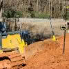
Leica Technology & Northern Corridor Improvements Project
We’re proud to be supplying Leica Geosystems survey technology, software and services to the Northern Corridor Improvements [NCI] project shortly underway on Auckland’s North Shore. The NCI project is a four year programme to build a continuous motorway route from the North Shore to/from the Western Ring Route. It will create a new connection between the Northern Motorway… Continue reading Leica Technology & Northern Corridor Improvements Project
SenSpot™ Wireless Structural Monitoring
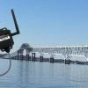
SenSpot™ from Resensys is a cost-effective, easy-to-install, wireless device for long-term bridge and structural monitoring. SenSpot™ sensors provide a versatile platform for remote monitoring of structures on a wide range of structural quantities; examples include strain (stress), vibration, tilt, inclination, temperature, humidity, and acoustic emission events. SenSpot™ are the world’s most energy efficient wireless monitoring… Continue reading SenSpot™ Wireless Structural Monitoring
Countdown To NZIS Conference 2018!

We’re counting down the days to the NZIS Conference 2018 on 17th – 19th May at the Rutherford Hotel in Nelson. This year’s conference promises to be bigger and better than ever with 3 days of powerful interactions planned. The event aims to showcase projects and connect members with the skills they need. The event… Continue reading Countdown To NZIS Conference 2018!
SmartFix Network Growth | Full Site List
New Sites Announced! We’re pleased to announce two more new sites have been added to our SmartFix Network. The two new stations are now active in Dargaville and Oamaru bringing our total stations across NZ to 83. The Hamilton site was also upgraded, going from GPS/Glonass to full GNSS (GPS/Glonass/Galilieo/Beidou). We’re well on the way to… Continue reading SmartFix Network Growth | Full Site List
How Much Faster Is The Leica GS18 T?
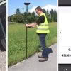
Setting out with a GNSS antenna requires total concentration. Looking at the instructions and values on the controller screen, moving the pole to the required position, and ensuring the pole is vertical by centering the pole bubble – all at the same time – needs careful execution and is not easy, especially when time pressure… Continue reading How Much Faster Is The Leica GS18 T?
Ground-Breaking Cultural Heritage Project Merging HDS, AR & VR Technology

The Unreality Journeys Team and G2 Foundation are pushing the boundaries of HDS, AR & VR technology in this ground-breaking cultural heritage project. This collective of AR/VR/MR visionaries, programmers and render artists are on a mission to create a virtual replicate world to showcase the beauty and history of Central America, starting with the entire country of Guatemala. Unreality… Continue reading Ground-Breaking Cultural Heritage Project Merging HDS, AR & VR Technology
Leica Pegasus | Mobile Reality Capture

Leica Geosystems offers a complete portfolio of mobile mapping solutions capturing point cloud & imaging data. Now there are two highly accurate mobile scanning solutions to choose from: Leica Pegasus:Backpack is the award-winning wearable capture solution. Leica Pegasus:Two is a vehicle-independent mobile mapping platform. Watch the video to see them in action! The Leica Pegasus:Backpack enables… Continue reading Leica Pegasus | Mobile Reality Capture
Leica Accredited | Global Survey Service Centre

Recently we welcomed Fulvio Dal-Molin, Senior Service Auditor from Leica Geosystems head office, this photo shows some of the team with Fulvio during his visit. Fulvio visits us regularly to audit our facilities and ensure we service, calibrate and repair instruments to the same standard as the Leica factory in Switzerland. Over the years the Global… Continue reading Leica Accredited | Global Survey Service Centre
Global Survey Partners With The University Of Waikato

We are honoured to be partnering with The University Of Waikato to ensure their School of Engineering is fully equipped with the latest Leica Geosystems technology. The new fleet of Leica total stations, GNSS smart antennas and Captivate software will be used by students on the new Civil Engineering Programme studying for their Bachelor of Engineering… Continue reading Global Survey Partners With The University Of Waikato