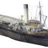
When you are involved in laser scanning you see the world differently. We get excited about unusual and interesting structures and often think “That would be amazing to scan!”. Few structures are more complex or intricate than maritime vessels, so when Lennon Bedford & Richard Harrison from our Christchurch team saw the historic Tug Lyttelton,… Continue reading Digitally Preserving NZ’s Maritime History with the Leica RTC360
Author: TR
Vitruvius utilise Leica Laser Scanning Technology for Northland’s Rail Upgrade
Upgrading Northland’s Rail Network The first section of track on the historic North Auckland Line (NAL) was opened in 1868 and the line was finally completed in full in 1925. NAL begins at Westfield in Auckland and runs for over 280km before terminating at Otiria in Northland. With many NAL assets nearing their ‘end of… Continue reading Vitruvius utilise Leica Laser Scanning Technology for Northland’s Rail Upgrade
Challenge Accepted: Testing the Leica GS18I Visual Positioning Technology

As part of our own internal training we decided to set our Survey Team a challenge: Measure a stockpile with the new Leica GS18I GNSS, first with the tilt pole and then with imagery using the GS18I’s innovative new Visual Positioning technology. Record the time it took to take the measurements and then analyse the… Continue reading Challenge Accepted: Testing the Leica GS18I Visual Positioning Technology
Mexteds Deliver Surface Perfection at Basin Reserve

The iconic Wellington Basin Reserve is well known as the home of New Zealand Cricket and admired for its rich history and superior playing conditions. Dating back to 1840 this historic venue has hosted many world-class events including the recent Black Caps test match victory against India. Keeping the ground surface up to international playing… Continue reading Mexteds Deliver Surface Perfection at Basin Reserve
Leica GS18 I – Imagine The Power Of Visual Positioning [Webinar]
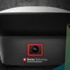
Join us for this Leica ANZ webinar introducing the new Leica GS18 I, a versatile, survey-grade GNSS RTK rover with Visual Positioning. The new Leica GS18 I is designed for surveying professionals to measure points which previously could not be measured with a GNSS rover easily and accurately. In this webinar we introduce the Leica… Continue reading Leica GS18 I – Imagine The Power Of Visual Positioning [Webinar]
Engcon Tiltrotator | Make Your Excavator More Profitable
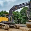
The world of civil construction is changing. Over the past 10 years across Europe, Scandinavia and the US, one of the most popular trends has been towards the mass adoption of tiltrotators. In some areas of the world the adoption has been so widespread that it’s unusual for a Contractor not to have a tiltrotator!… Continue reading Engcon Tiltrotator | Make Your Excavator More Profitable
Woods Survey Team | Overcoming Construction Project Challenges
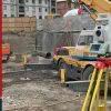
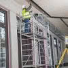
Woods have been busy flexing their construction surveying muscles on the new Quest apartments in Takapuna on Auckland’s North Shore. Bufton Construction are the main contractor tasked with building this new 5-story multi-use structure, comprised of 26 basement car parks, commercial tenancies on the ground floor, 51 hotel rooms and 6 private apartments due for… Continue reading Woods Survey Team | Overcoming Construction Project Challenges
The Vital Role of Laser Scanning in Heritage Conservation

Time is not always a friend to our treasured and historic structures. Whilst these structures present architectural challenges as they age, the need to preserve and evolve each one carefully and thoughtfully is necessary for their long-term survival. Around the world, architecture, engineering and construction (AEC) professionals work to implement new technology in renovation and… Continue reading The Vital Role of Laser Scanning in Heritage Conservation
How is the New Leica Nova MS60 MultiStation Different?

In simple terms, the new Leica Nova MS60 MultiStation is a new class of instrument, based on a Total Station but with the power to “do it all”. When Leica Geosystems introduced the world’s first MultiStation in 2013, the MS50, they introduced the term “mergeTEC” to represent the merging of technologies. This term still fits… Continue reading How is the New Leica Nova MS60 MultiStation Different?
Accelerating Construction Layout with Digital Construction Tools [Webinar]
An Introduction to the Leica iCON Construction Range The construction industry is on the verge of adopting a range of new technologies. With increasingly complex job sites, what is the best way for construction firms to thrive? Two words: Going digital. Many progressive organisations and contractors have already eliminated rework and streamlined workflows through digital… Continue reading Accelerating Construction Layout with Digital Construction Tools [Webinar]